Iceland’s Geography: From Mountains to Ice Fields
Iceland, a small island located in Breiðafjörður Bay, is a country known for its unique geographical features. From snow-capped mountains to stunning fjords, Iceland offers a diverse and everchanging landscape that attracts adventurers from around the world. In this article section, we will explore some of the most significant geographical landmarks in Iceland, as well as the country’s size and climate.
Iceland: An Island Country with Unique Geographical Features
One of the most notable geographical features in Iceland is the Vatnajökull Glacier. As the largest glacier in Europe, it covers approximately 8% of Iceland’s landmass. This massive glacier is a sight to behold, with its sprawling ice fields and majestic ice caves. Visitors can explore the glacier on guided tours, witnessing its beauty up close.
Another well-known landmark in Iceland is Geysir, the namesake for all other geysers. This natural wonder erupts with hot water and steam every few minutes, creating a spectacular show for onlookers. Located in the Golden Circle, Geysir is a must-visit destination for those seeking to witness the power of nature.
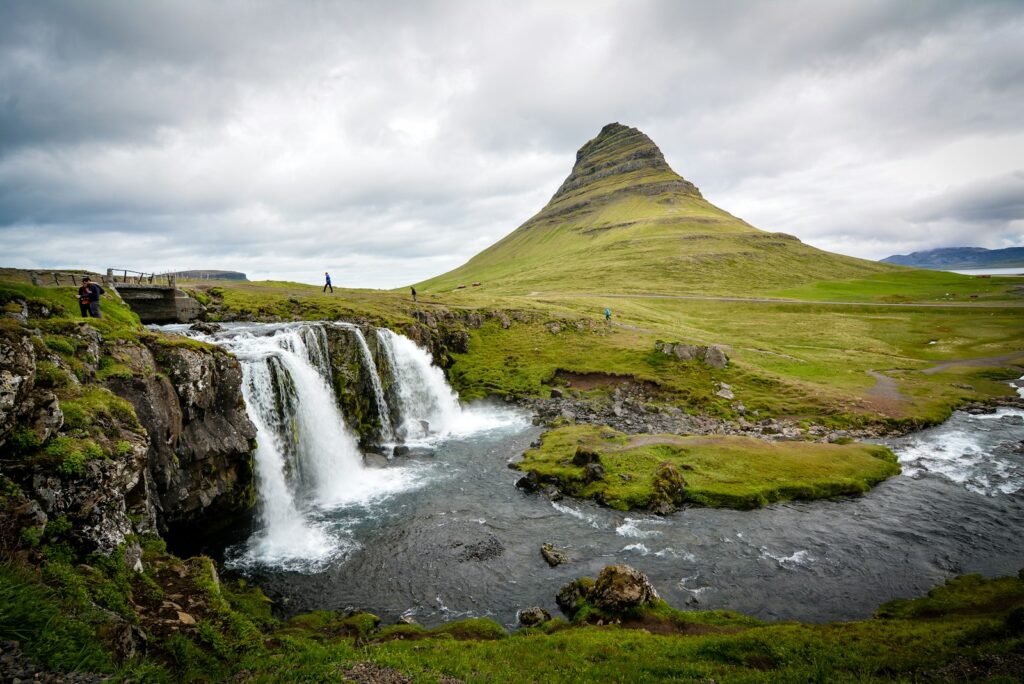
Gullfoss is another remarkable natural feature of Iceland. This waterfall, located in the canyon of the Hvítá river, drops 100ft into a narrow gorge, creating a breathtaking spectacle. The sheer power and beauty of Gullfoss make it one of Iceland’s most iconic landmarks.
Þingvellir National Park is a UNESCO World Heritage Site that showcases Iceland’s unique geological and historical significance. This park is located on the boundary between the North American and Eurasian tectonic plates, making it a site of geological importance. Additionally, Þingvellir is where the world’s oldest existing parliament, the Alþingi, was established in 930 AD. Visitors to Þingvellir can explore the park’s stunning landscapes and learn about Iceland’s rich history.
In terms of size, Iceland is about the same size as Hungary and Portugal, or Kentucky and Virginia. At its widest, the country measures 500 km east to west and 300 km north to south. With a coastline of 4,970 km, Iceland offers stunning views of the surrounding ocean. It is even possible to drive around the entire island on a 10-day holiday, experiencing the diverse landscapes and breathtaking scenery along the way.
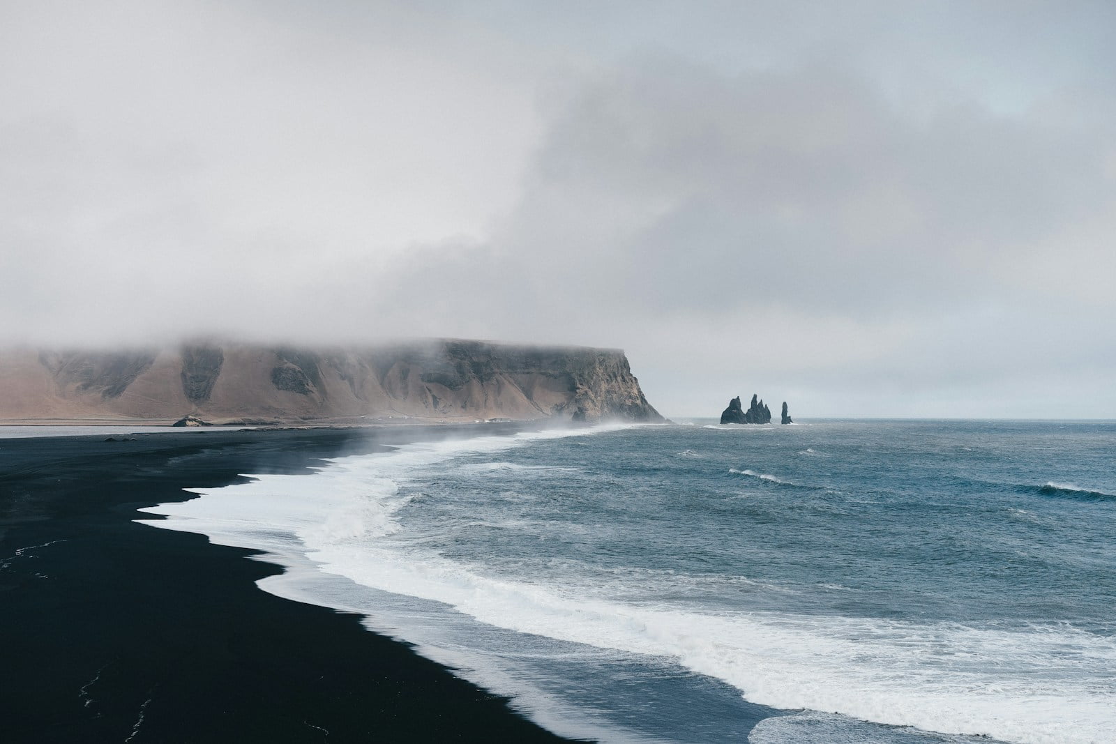
Iceland’s geography is characterized by plateaux, mountain peaks, and fertile lowlands. The country is also home to many long, deep fjords and glaciers, including Vatnajökull, Europe’s largest glacier. The landscape is further enhanced by its waterfalls, geysers, volcanoes, black sand beaches, and otherworldly steaming lava fields. The diverse terrain of Iceland creates a truly unique and awe-inspiring environment for visitors to explore.
The Power and Presence of Volcanoes
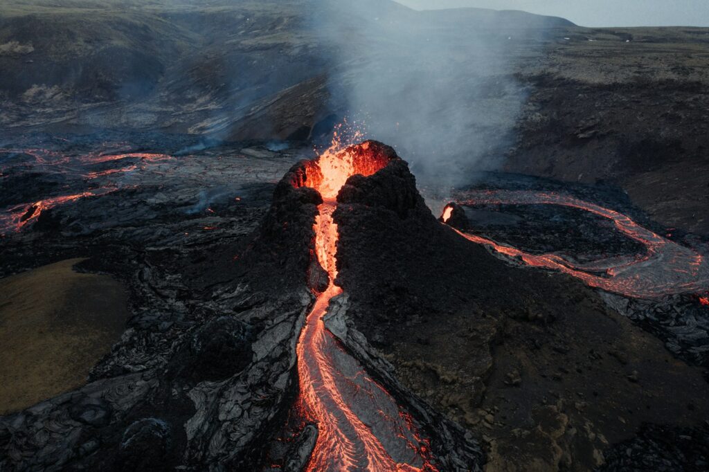
Iceland, known for its stunning landscapes and unique geography, is a land shaped by the power and presence of volcanoes. With approximately 30 active volcanic systems and hundreds of volcanoes, the island stands as a testament to the awe-inspiring forces of nature.
Volcanoes in Iceland are a result of the country’s location on the Mid-Atlantic Ridge, where the Eurasian and North American tectonic plates meet. This tectonic activity creates a hotbed of volcanic activity, with eruptions occurring relatively frequently. The island is composed primarily of basalt, a type of low-silica lava associated with effusive volcanism, similar to the volcanic activity seen in Hawaii.
However, what sets Iceland apart is the variety of volcanic types present on the island. In addition to basalt, there are also composite and fissure volcanoes, which produce more evolved lavas such as rhyolite and andesite. This diversity in volcanic activity contributes to the unique landscapes and geological features that can be found across Iceland.
The power of these volcanoes is not only evident in their frequent eruptions but also in the geothermal energy they provide. Iceland’s volcanic activity, combined with its abundance of hot springs and geothermal areas, has made the country a leader in geothermal energy production. The geothermal resources are harnessed to generate electricity and heat, providing most residents with inexpensive hot water, heating, and electricity. This reliance on geothermal energy has not only reduced the country’s dependence on fossil fuels but has also made Iceland a model for sustainable energy practices.
The Mid-Atlantic Ridge and Tectonic Activity
Iceland, known for its stunning landscapes and volcanic activity, owes its unique geographical features to the Mid-Atlantic Ridge and the tectonic activity occurring beneath its surface. Located at the meeting point of the Eurasian and North American tectonic plates, Iceland sits atop a volcanic hotspot, resulting in its constant volcanic activity and ever-changing landscape.
The Mid-Atlantic Ridge is a vast underwater mountain range that runs through the Atlantic Ocean, dividing it into two halves. It is along this ridge that the Eurasian and North American tectonic plates are slowly spreading apart. Iceland, being situated directly on top of this ridge, experiences the direct effects of this tectonic activity.
As the two tectonic plates move apart, magma from the Earth’s mantle rises to fill the gap, resulting in volcanic eruptions and the creation of new land. This continuous movement and eruption of magma contribute to the growth of Iceland, with the landmass expanding by approximately 2 centimeters per year in the middle.
The volcanic activity in Iceland is unparalleled, with 32 active volcanic systems erupting on average every four years. This high frequency of eruptions is a direct result of the tectonic activity occurring along the Mid-Atlantic Ridge. The volcanic activity not only shapes the landscape but also influences the island’s geothermal energy resources, making it a unique and valuable natural asset.
Notable Volcanoes and Volcanic Activity
Iceland, known as the “Land of Fire and Ice,” is a country renowned for its spectacular volcanic activity. With a history of volcanic eruptions that have shaped its landscapes and influenced its climate, Iceland is home to several notable volcanoes.
One of the most famous volcanoes in Iceland is Mt. Hekla. Despite being expected to remain dormant for a hundred years after its 1947 eruption, Mt. Hekla surprised scientists with eruptions in August 1980, April 1981, and January 1991. These eruptions showcased the unpredictability of volcanic activity in Iceland. Mt. Hekla is a symbol of the country’s volcanic nature and has attracted adventurers and nature enthusiasts who seek to witness its awe-inspiring eruptions.
Another significant volcanic event in Iceland’s history occurred in January 1973 on Heimaey Island in the Westmann Islands. This eruption forced the evacuation of all 5,000 residents and resulted in the destruction of more than 300 homes and buildings. The eruption on Heimaey Island served as a stark reminder of the power and devastation that volcanic activity can bring.
The Krafla area, near Lake Myvatn, has also experienced notable volcanic activity. In December 1975, a volcanic eruption in this region lasted several days. Since then, the area has seen seven lesser eruptions, indicating ongoing volcanic activity. Scientists expect further volcanic activity to occur in the Krafla area, emphasizing the dynamic nature of Iceland’s volcanic landscape.
Geothermal Power and Hot Springs
Iceland is known for its abundant geothermal resources, which play a significant role in the country’s energy production and unique natural attractions. Geothermal power and hot springs are a vital part of Iceland’s identity and have shaped both its landscape and culture.
With volcanic activity creating an abundance of geothermal areas, Iceland harnesses its geothermal energy for various purposes. Nonpolluting geothermal energy supplies an impressive 89 percent of the country’s heating needs. This sustainable and eco-friendly energy source is made possible by tapping into the heat stored beneath Iceland’s volcanic landforms.
Hot springs are a prominent feature of Iceland’s geothermal areas. These natural thermal pools are formed when groundwater is heated by geothermal activity and rises to the surface, offering locals and visitors a chance to relax and rejuvenate in warm, mineral-rich waters. The most famous and popular hot spring in Iceland is the Blue Lagoon, located near Reykjavik. This geothermal spa is renowned for its milky blue waters and is a must-visit destination for travelers seeking a unique and therapeutic experience.
Beyond the Blue Lagoon, there are numerous other geothermal pools and hot springs scattered throughout the country. These natural wonders provide an opportunity to immerse oneself in Iceland’s geothermal heritage, surrounded by stunning landscapes. From the Secret Lagoon in Fludir to the Myvatn Nature Baths in the north, each hot spring offers a distinct setting and experience.
Glaciers and Lava Fields
The Largest Glacier and Glacial Activity
One of Iceland’s most prominent geographical features is its glaciers, which have played a significant role in shaping the country’s landscape. The largest glacier in Europe outside the polar regions is Vatnajökull, covering an impressive 9000 square kilometers. It stands as a magnificent testament to the power of nature and the delicate balance between frost and fire that characterizes Iceland.
Glaciers in Iceland, including Vatnajökull, Langjökull, and Hofsjökull, have been steadily retreating since 1930 due to climate changes. This accelerated rate of retreat is a cause for concern, as it signifies the impact of global warming on these majestic ice formations. It is predicted that within the next 200 years, all glaciers in Iceland will disappear, forever altering the country’s landscape.
The formation of glaciers in Iceland is a fascinating phenomenon that may seem contradictory at first. While volcanoes are typically associated with heat and fire, they are also responsible for the creation of glaciers. When volcanic activity occurs, the intense heat melts the surrounding ice and snow, which then flows down the slopes and collects in valleys to form glaciers. This interplay between fire and ice is a unique characteristic of Iceland’s geography.
The glacial activity in Iceland is not just limited to the existence and of the glaciers themselves. The country’s location under the Aurora oval, a doughnut-shaped ring around the Arctic and Antarctic, plays a role in directing cosmic particles towards Iceland. These particles, known as solar wind, create mesmerizing displays of light in the sky called the Northern Lights or Aurora Borealis. While most of these particles bounce back to space, a fraction of them gets directed towards the Aurora oval, of which Iceland is conveniently placed under. This makes Iceland an ideal location for witnessing this breathtaking natural phenomenon.
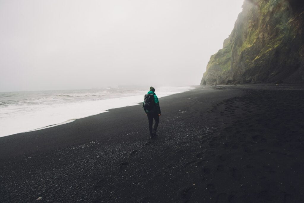
Black Sand Beaches and Lava Fields
The southern portion of Iceland is home to some of the most remarkable geological features on the island, including black sand beaches and lava fields. These unique landscapes are a result of the volcanic activity that has shaped the region over thousands of years.
Black sand beaches can be found along the southern coast of Iceland, offering a striking contrast to the surrounding green hills and cliffs. These beaches get their distinctive color from volcanic minerals and rock fragments that have been eroded and ground down over time. The black sand is made up of tiny particles of basalt, a type of volcanic rock that is common in the area.
One of the most famous black sand beaches in Iceland is Reynisfjara, located near the village of Vik. This beach is renowned for its dramatic basalt columns, towering cliffs, and powerful crashing waves. Visitors can take in the breathtaking views, explore the unique rock formations, and even spot puffins nesting in the cliffs during the summer months.
Lava fields are another fascinating feature of the southern landscape. These expansive areas are covered in solidified lava flows that have cooled and hardened over time. The lava fields are a reminder of Iceland’s volcanic history and provide a glimpse into the powerful forces of nature that have shaped the island.
One of the most well-known lava fields in Iceland is the Eldhraun lava field, which was created by a massive eruption in the late 18th century. This vast expanse of black, moss-covered lava stretches for miles and creates an otherworldly atmosphere. Visitors can hike through the lava field and witness the unique interplay between the hardened lava and the vibrant green moss that blankets the landscape.
Exploring the black sand beaches and lava fields of southern Iceland offers a captivating experience for nature enthusiasts and adventure seekers alike. These natural wonders provide a glimpse into the geological processes that have shaped the island and offer a stark beauty that is unlike anywhere else in the world. Whether strolling along the black sand beaches or hiking through the ancient lava fields, visitors are sure to be awed by the raw power and mesmerizing beauty of these unique landscapes.
The Mountainous Landscape
Mountain Ranges and Peaks
Iceland, known for its stunning natural landscapes, is home to several mountain ranges and peaks that captivate visitors from around the world. The country’s unique geology, shaped by volcanic activity and glaciation, has given rise to these majestic formations.
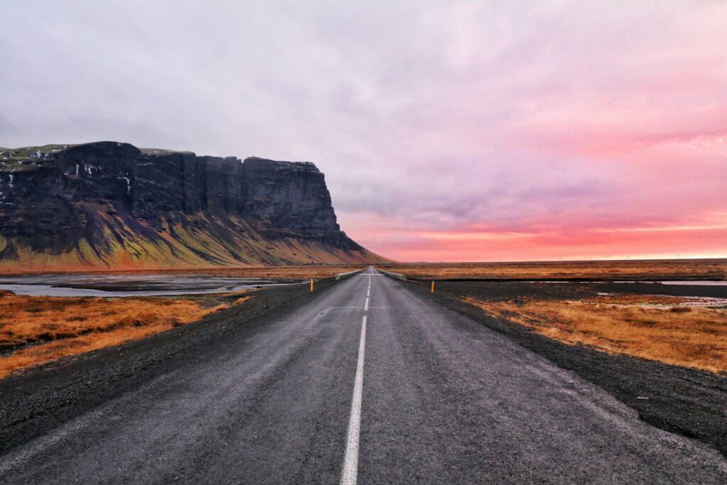
One of the most notable mountain ranges in Iceland is located in the southern portion of the country. Here, you will find volcanoes such as Hekla, Eldgjá, and Katla, which have played significant roles in shaping the landscape over centuries. These volcanoes, alongside numerous glaciers like Vatnajökull, Mýrdalsjökull, and Eyjafjallajökull, create a dramatic and awe-inspiring sight. The contrasting colors of basalt columns, black sand beaches, and pristine white ice contribute to the unique beauty of the area.
Hvannadalshnjúkur, Iceland’s highest peak, is also found in the southern region. Standing tall at an impressive height, it offers breathtaking panoramic views of the surrounding glaciers and volcanic landscapes. The challenging climb to the summit attracts adventure enthusiasts and mountaineers from around the world, seeking to conquer this natural wonder.
Moving towards the eastern part of Iceland, you will discover an abundance of vegetation and birch forests. This area provides a stark contrast to the rugged volcanic landscapes found in other parts of the country. The lush greenery and vibrant colors create a tranquil and picturesque setting, offering a refreshing change of scenery.
Iceland’s mountain ranges and peaks are not only visually captivating but also play a significant role in the country’s geography and climate. These towering formations act as natural barriers, influencing weather patterns and creating diverse microclimates across the island. They also contribute to the formation of glaciers, which cover approximately 10.2 percent of Iceland’s total land area.
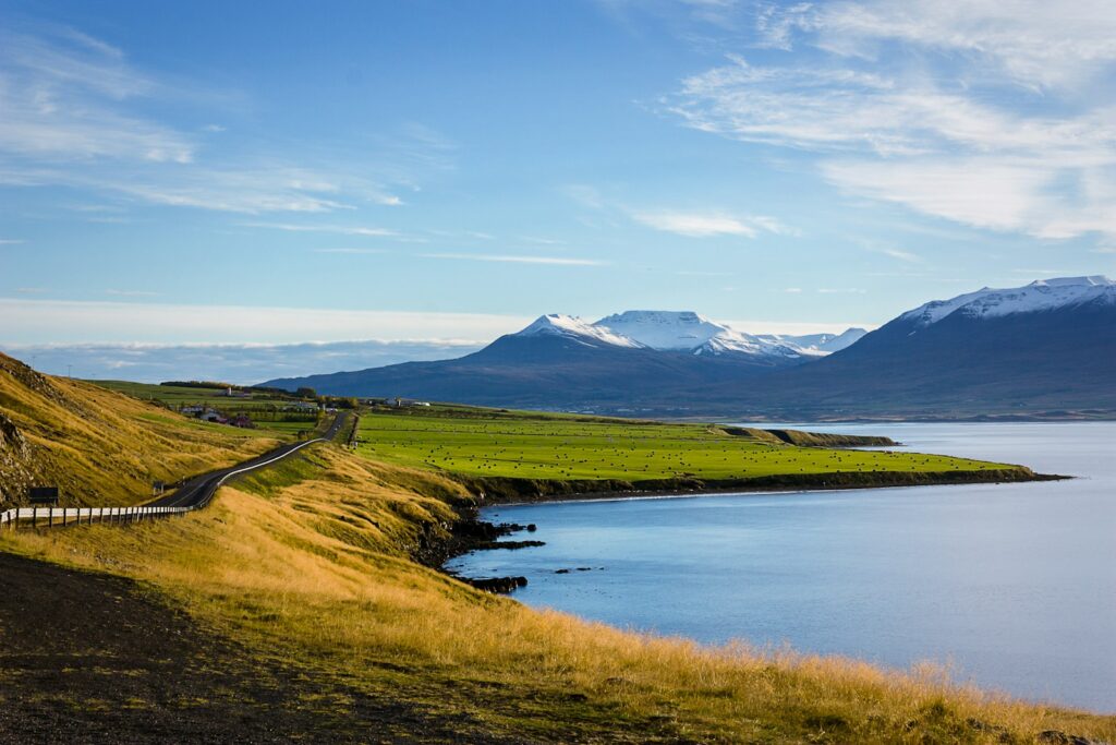
The Mountain of Hafnarfjall
Located in the western portion of Iceland and rising over the landscape with its impressive height of 804 meters (2,638 ft), Hafnarfjall Mountain is a prominent natural feature in the region. Situated in the vicinity of Reykjavík and north of the Capital Region, this majestic mountain offers breathtaking views and a glimpse into Iceland’s rugged and awe-inspiring beauty.
Hafnarfjall Mountain is a well-known landmark in the west of Iceland, attracting both locals and tourists alike. Its steep slopes and rocky terrain make it a popular destination for hiking enthusiasts and outdoor adventurers seeking a thrilling and rewarding experience. The mountain offers various trails of different difficulty levels, allowing visitors to choose the one that suits their preferences and fitness levels.
As hikers ascend Hafnarfjall Mountain, they are rewarded with stunning panoramic views of the surrounding landscapes. On a clear day, one can see the picturesque fjords, valleys, and coastline stretching out in all directions. The rugged beauty of the mountain is truly captivating, and it serves as a reminder of the raw power and natural wonders that Iceland has to offer.
In addition to its natural beauty, Hafnarfjall Mountain also holds cultural and historical significance. The mountain takes its name from the nearby town of Hafnarfjörður, which translates to “harbor fjord.” Hafnarfjörður is a charming coastal town known for its fishing heritage and vibrant cultural scene. The mountain has served as a backdrop to the town’s development over the years, shaping its identity and providing a sense of place.
Hafnarfjall Mountain is not only a symbol of Iceland’s natural splendor but also a testament to the country’s geological history. Like many areas in Iceland, Hafnarfjall Mountain showcases volcanic activity that has shaped the landscape over thousands of years. As visitors explore its slopes, they may be able to witness the remnants of volcanic eruptions, such as lava formations and other geological features, serving as a reminder of the ever-changing nature of the island.
The Climate and Seasons of Iceland
Cool Summers and Daylight Hours
Reykjavik, the capital city of Iceland, is renowned for its cool summers and unique daylight hours. Due to its coastal location and the influence of the North Atlantic Current, the city experiences relatively mild winters and cool summers.
During the summer months of June to August, Reykjavik enjoys long daylight hours, allowing visitors to make the most of their time exploring the city and its surrounding attractions. With the sun barely setting, travelers can enjoy up to 20 hours of daylight, providing ample time for outdoor activities and sightseeing. The extended daylight hours also create a vibrant atmosphere, with locals and tourists alike taking advantage of the pleasant weather to enjoy outdoor events, festivals, and picnics.
However, despite the extended daylight, Reykjavik’s summers are cooler compared to similar latitudes in mainland Scandinavia. Temperatures typically range between 10 and 15 °C (50 and 59 °F) and rarely exceed 20 °C (68 °F). The city’s exposed west coast location exposes it to maritime winds, which contribute to the cooler summer temperatures. These conditions make Reykjavik a refreshing destination for those seeking a break from the heat commonly experienced in other parts of the world during the summer months.
While the cool summers may not be ideal for sunbathing or swimming, they offer a unique opportunity to explore the city’s cultural attractions and natural wonders without the discomfort of extreme heat. Visitors can immerse themselves in the vibrant arts scene, with notable landmarks such as the Harpa Concert Hall and Conference Centre showcasing a range of performances and exhibitions. Museums like the National Museum of Iceland and the Reykjavik City Museum provide insights into the country’s rich history and heritage.
Additionally, the cooler summer temperatures in Reykjavik make outdoor activities such as hiking, biking, and whale watching more enjoyable. The city’s proximity to natural wonders like geothermal pools, lava fields, and waterfalls allows visitors to experience Iceland’s stunning landscapes in a comfortable climate.
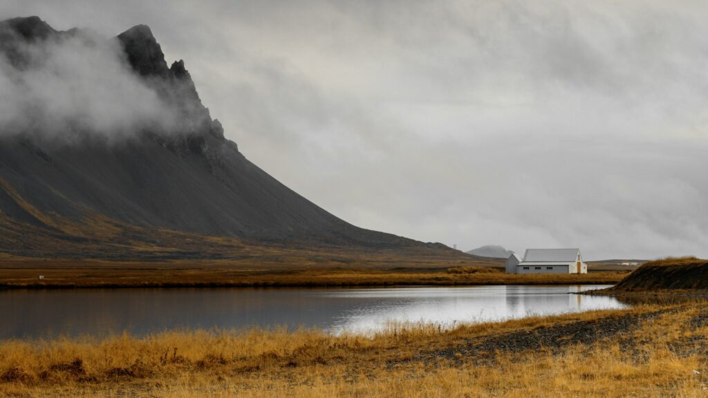
The Unpredictable Weather of Iceland
Iceland is notorious for its unpredictable weather, with locals often saying, “If you don’t like the weather, just wait five minutes.” This small island nation, located in the North Atlantic Ocean, experiences a unique climate that can change rapidly, making it essential for visitors to be prepared for all types of conditions.
The coastal climate of Iceland is influenced by both cold polar currents and the warm Gulf Stream, resulting in cool summers and mild winters. The average temperature in the capital city of Reykjavik ranges from 0.4°C (32°F) in January to 12.5°C (54.5°F) in July. However, these averages do not tell the whole story.
One of the defining characteristics of Icelandic weather is its volatility. Within the span of a single day, you can experience sunshine, rain, wind, and even snow. It is not uncommon to see all four seasons in just a few hours. The wind in Iceland blows year-round, and during winter, a wind chill factor between -15°F and 10°F is common. In fact, the capital city of Reykjavik can experience winds reaching hurricane force during the winter and spring months.
Precipitation in Iceland is another factor that contributes to its unpredictable weather. The country receives an average of 31 inches of rainfall annually, with the highest amounts occurring in the fall and early winter. However, rain can occur at any time of the year, even during the winter months when snow is more expected. Snowfall can begin as early as September and can last until June, although large accumulations of snow are rare.
The daylight hours in Iceland also add to the variability of its weather. Located so far north, the amount of daylight varies greatly throughout the year. After the winter solstice on December 21, the country experiences an average daily gain of 6 minutes of daylight, while after the summer solstice on June 21, a daily loss of 6 minutes follows. This means that in the winter months, daylight can be limited, while in the summer, Iceland experiences long daylight hours, known as the midnight sun.
When planning a trip to Iceland, it is essential to be prepared for the unpredictable weather. Layered clothing, waterproof jackets and pants, sturdy footwear, and accessories such as hats and gloves are recommended. It is also advisable to check the weather forecast regularly, as conditions can change rapidly. Even during the summer months, it is wise to bring warm clothing, as temperatures can drop significantly, especially in the evenings.
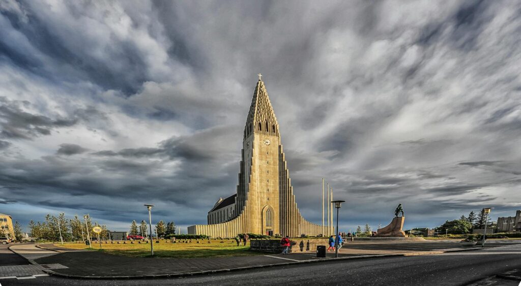
The Capital City and Other Major Towns
The Capital Region of Iceland, home to the vibrant city of Reykjavík, is the most densely populated area in the country. Situated on the southwest coast of the island, the region is located near the Southern Peninsula. Reykjavík is predominantly located on the Seltjarnarnes peninsula, offering stunning views of the surrounding natural landscapes.
Reykjavík, Iceland’s capital, is a bustling and cosmopolitan city that offers a blend of modern amenities and rich cultural heritage. It serves as the economic, political, and cultural hub of the country. The city is known for its vibrant arts scene, with numerous galleries, museums, and theaters showcasing both traditional and contemporary Icelandic art and culture.
The Capital Region is not only home to Reykjavík but also encompasses other major towns. One such town is Hafnarfjörður, located just south of Reykjavík. Known for its picturesque harbor and charming old town, Hafnarfjörður offers a quaint atmosphere with a rich Viking history. The town is also famous for its annual Viking festival, where visitors can immerse themselves in Norse traditions and enjoy live reenactments.
Another major town in the Capital Region is Kópavogur, which is the second-largest municipality in Iceland. Located just southeast of Reykjavík, Kópavogur is a residential area with a strong emphasis on community and outdoor spaces. The town is known for its beautiful parks, including the popular Smáralind Park, which offers recreational activities for people of all ages.
In addition to the Capital Region, there are other significant towns across Iceland that contribute to the country’s cultural and economic landscape. Akureyri, located in the north of Iceland, is often referred to as the “Capital of the North.” This charming town offers a vibrant arts scene, with numerous galleries and music festivals. It is also a gateway to some of Iceland’s most spectacular natural wonders, including the nearby Lake Mývatn and Dettifoss waterfall.
Another notable town is Ísafjörður, located in the Westfjords region of Iceland. This picturesque town is surrounded by stunning fjords and snow-capped mountains, offering breathtaking scenery. Ísafjörður is known for its rich maritime history and is a popular destination for outdoor enthusiasts, offering activities such as hiking, skiing, and kayaking.

